Cristel Copper Gold Silver Tin Project
100% INTEREST
3,600 HECTARES titled & under application
DEPARTMENT OF PUNO, SOUTH-EASTERN PERU
Cristel is located in the San Rafael district of southern Peru, which hosts one of the largest operating tin mines in the world. Cristel is part of Palamina’s battery metal acquire and hold strategy.
Overview, Infrastructure & Geology
The Cristel copper-tin-silver project is located in the San Rafael mining district in south-eastern Peru, within the Department of Puno, at an elevation of ~4,500 metres. The project lies approximately 170km north of the city of Juliaca and 40km north of Minsur´s giant San Rafael tin-copper mine, the world´s fourth largest tin producer. Minsur’s current measured and indicated resources at San Rafael are 7.6Mt at a grade of 2.93% and an additional inferred resource of 2.5Mt at a grade of 2.06% Sn (Minsur, annual report 2023). Minsur is actively exploring this belt, advancing several near mine and brownfields projects in the belt. Palamina has a field office in Juliaca where access to the project is a 3.5 hour drive by highway then dirt road.
Palamina acquired the Cristel concessions through staking to cover a large colour anomaly located within this prolific metallogenic belt. The Cristel area was drilled in the late 2000’s by Consorcio Minero Horizonte, a local Peruvian mining company, chasing after tin-copper mineralization similar to San Rafael. The four holes completed targeted geophysical anomalies along the eastern flank of the anomaly where the drilling program was cut short due to budget constraints.
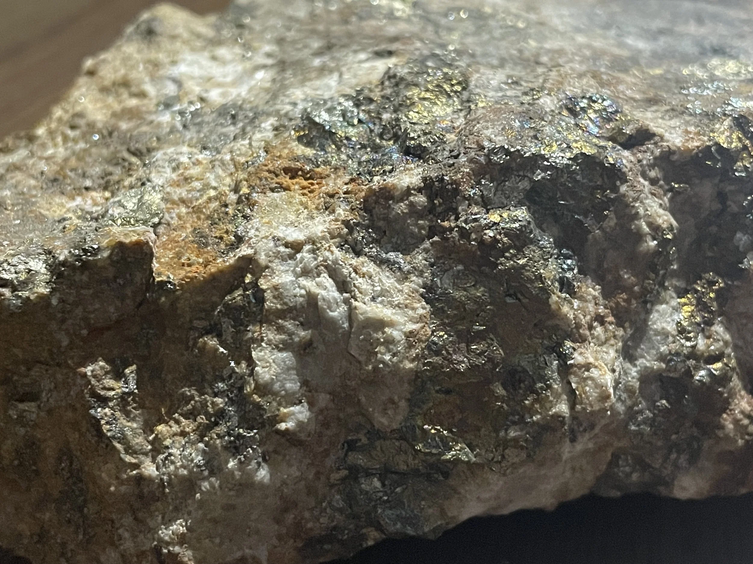
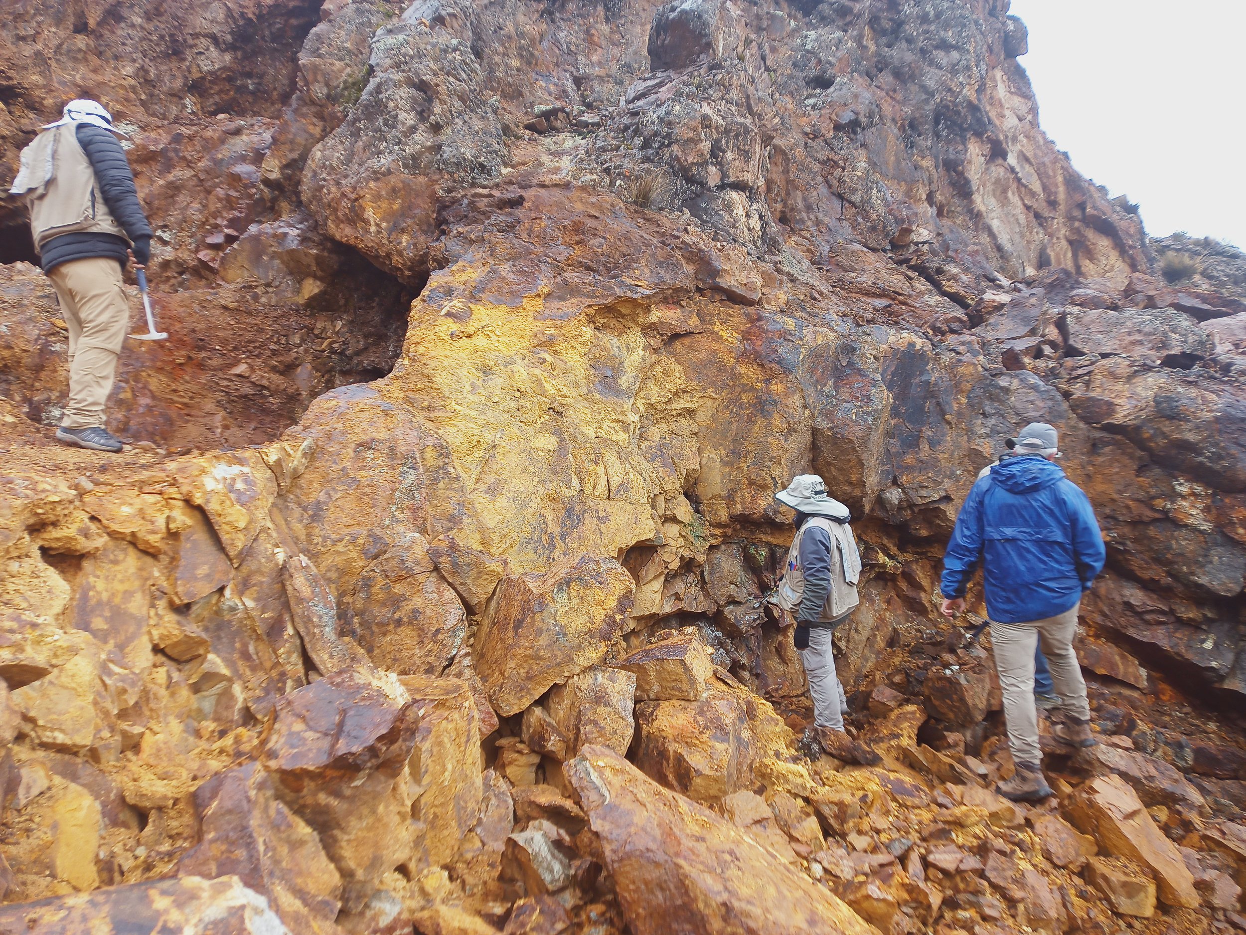
Palamina has identified a large 2 x 2 km colour anomaly at Cristel, consisting of argillic and advanced argillic “ribs” cutting through monzonite intrusive and Paleozoic country rock, often hosting hydrothermal breccias with visible copper and silver oxide mineralization.
In 2022, limited sampling (8 rock chips) by Palamina geologists has found anomalous copper and gold results from the altered intrusion, with values up to 4.43% Cu, 0.61 g/t Au and 24.7 g/t Ag.
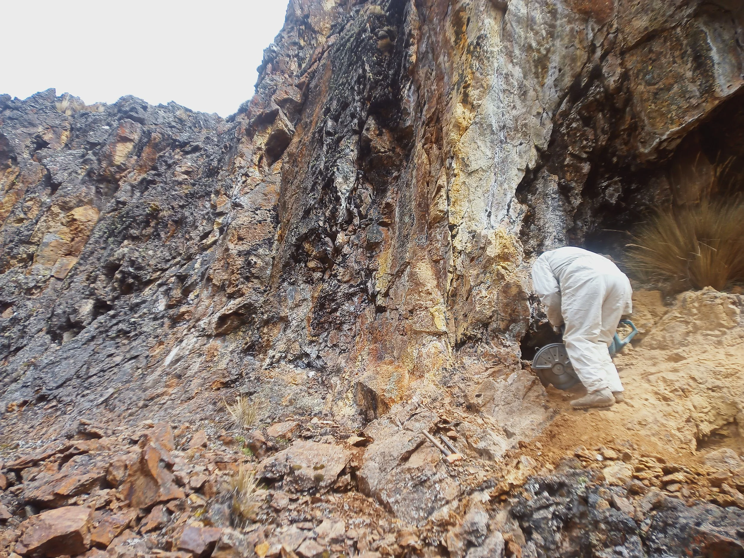
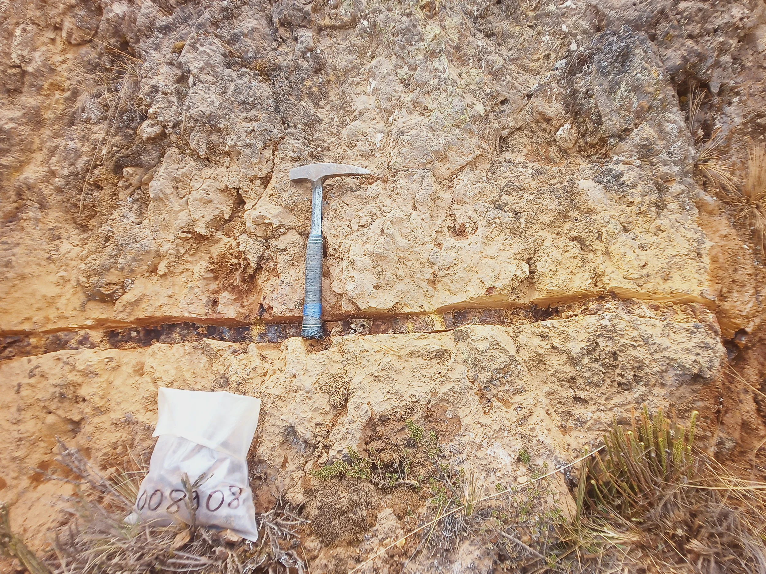
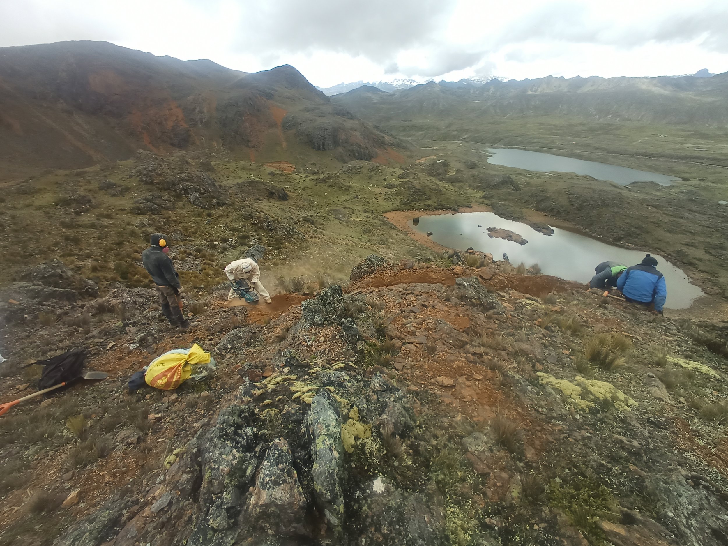
Palamina has not conducted any drilling in the Cristel claims. In 2025, Palamina carried out two site visits with plans to complete a systematic rock chip sampling and detailed mapping to better define the alteration areas and determine the extent of the geochemical anomaly.
Select results from sampling in 2022 and 2025 are summarized below:
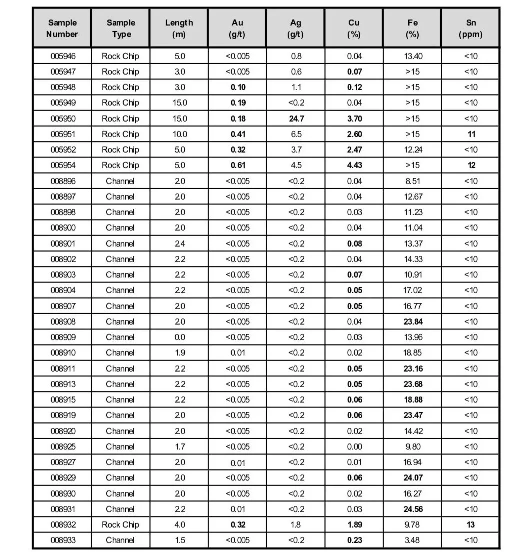
Table 1 – Results of rock & channel sampling from the Cristel Project
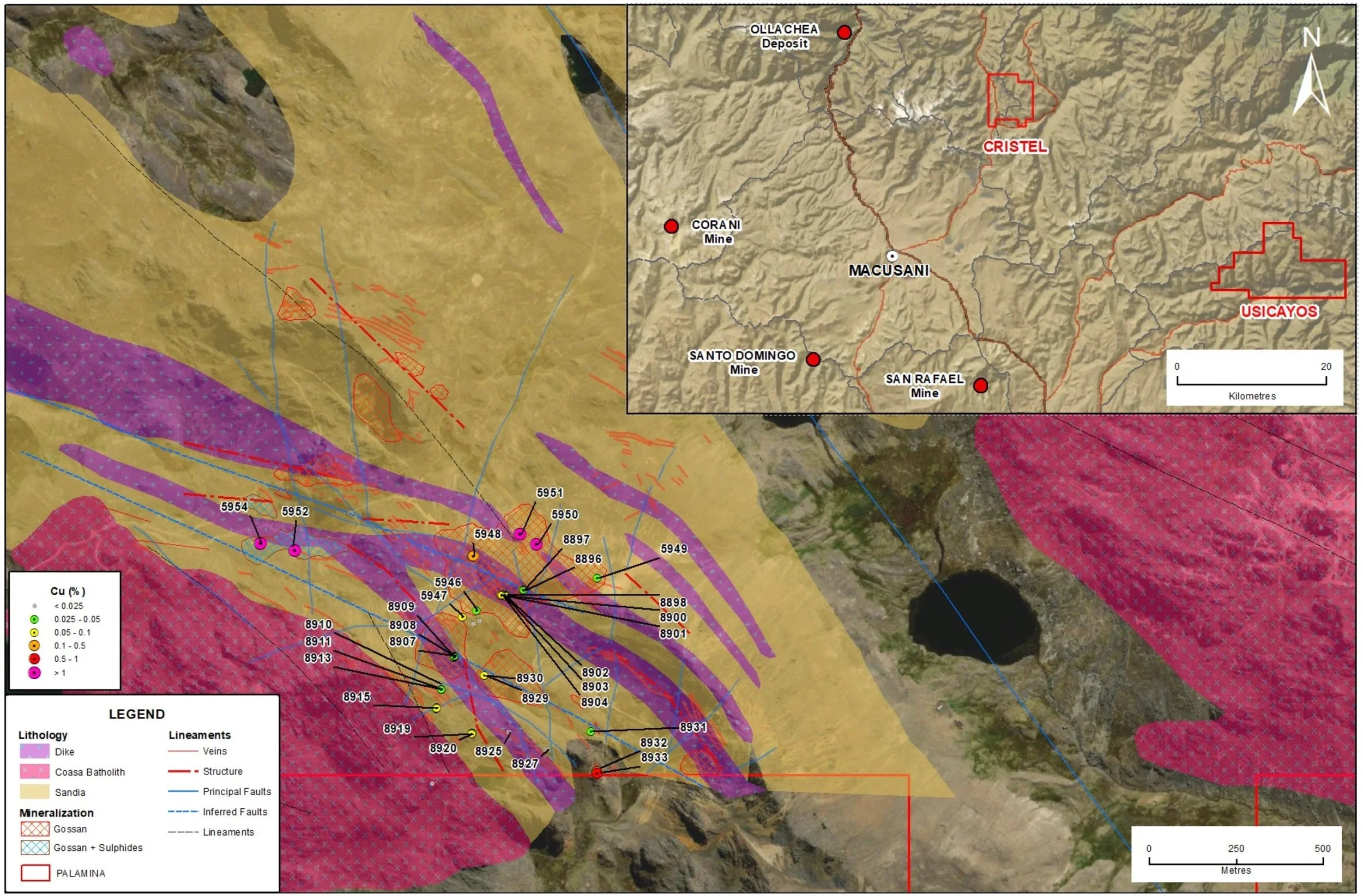
Figure 1 – Location of chip & channel samples at the Cristel Project
Geological Summary
The geology of the Cristel Project is dominated by metasedimentary rocks of the Ordovician Sandia Formation, which have been intruded by stocks, sills and dikes of intermediate granitic rocks. Work at Cristel is in the early stages, but mineralization is thought to represent a magmatic-hydrothermal system with mineralization spatially related to the dikes.
Broadly speaking, mineralization consists of veins and veinlets of quartz and sulfides (and their weathering products), hydrothermal breccias, and silicified meta-sandstones. Where unoxidized, mineralization occurs as pyrite, pyrrhotite, arsenopyrite, chalcopyrite and bornite. When oxidized, mineralization consists of gossans of iron and manganese oxides with associated secondary copper minerals and scorodite. Gangue minerals include quartz, calcite and siderite. It is the oxidized sulfides across the Property that create a prominent “color anomaly” that can be observed from distance.
In detail, two vein systems are present. The northern system consists of veins two to six meters in width, and the southern system consists of veins up to 15 meters in width.
Property History
Small historical workings are scattered across the property, focused primarily on veins and gossans. In the early 2000’s Desafil Minero S.A.C., a subsidiary of Consorcio Minero Horizonte (‘Horizonte’), conducted ground magnetics and induced polarization surveys on a portion of the property. Rock samples were also collected at this time. No data from this work is available, although some small geophysical maps are available in a student thesis.
In 2008, four holes of a planned 18-hole core drilling program were completed by Horizonte over a total of 2,227 meters. The holes were designed to test the down-dip projection of mineralization encountered at surface, or geophysical anomalies. No detailed results are available, but two of the four holes intersected narrow mineralized intervals ranging between 0.5% and 1% copper over less than 1 meter. It is noteworthy that the holes are drilled in the opposite direction (away from) the bulk of the sampling by Palamina.
Gallery