
Gaban Gold Project

Palamina holds 7 projects in the Puno Orogenic Gold Belt
100% INTEREST
10,100 HECTARES
DEPARTMENT OF PUNO, SOUTH-EASTERN PERU
The Property is located in high jungle on the north western edge of the Puno Orogenic Gold Belt (“POGB”) and south of the of the juncture of the San Gaban and Inambari rivers. Palamina is exploring the Gaban project as a potential hard rock source for the alluvial gold being mined on the property and at Madre de Dios in the Amazon basin to the north.
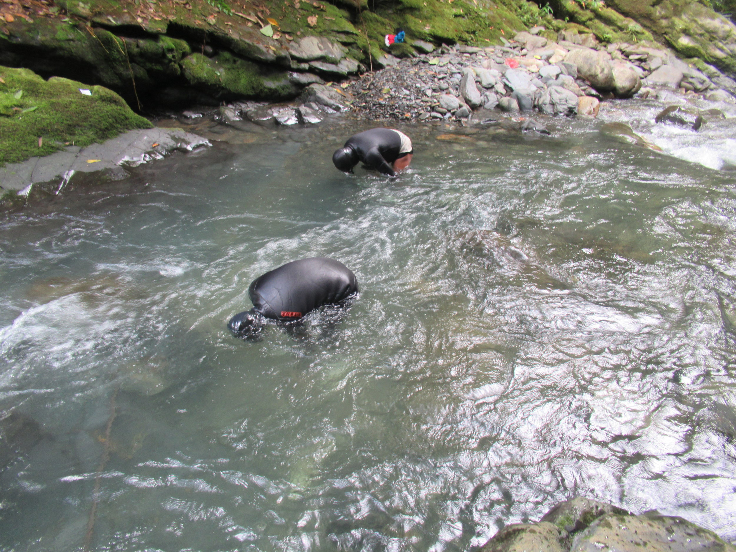
Artisanal miners recover alluvial gold from drainages transecting the property using dredges and sluice boxes. One alluvial miner recovered a 0.44 kilogram weight gold nugget from the Yanamayo stream below the Yanamayo ridge.

The town of San Gaban, at 550m above sea level, is served by excellent infrastructure; it is a four-hour drive via the Trans-Oceanic Highway to Puerto Maldonado international airport to the north and a nearby 206 megawatt hydro-electric dam provides power to the town.
The focus of exploration to date has been primarily in the Coritiri zone which is surrounded by a series of ridges at higher elevation (outlined in white). The most southern ridge sits at an ~1,800 metres elevation and the lower northern portion between 800 and 1,200 metres elevation where the Yanamayo river outlets into the San Gaban river. Palamina believes that the hard rock source of the alluvial gold in the Coritiri and Yanamo streams is from these surrounding ridges.

The Gaban gold project is 30 km north of the Ollachea gold deposit along the intercontinental highway completed in 2008. Three hydroelectric dams servicing Peru have been constructed along the San Gaban river between Ollachea and Gaban.
The Mucumayo hard rock mines area hosts 12 underground gold mines run by co-operatives and informal miners. Road access has caused a gold rush and boom in this area. The historic Santo Domingo mine (highest grade gold mine in South America at turn of 19th century) sits to the south west along the Inambari river.

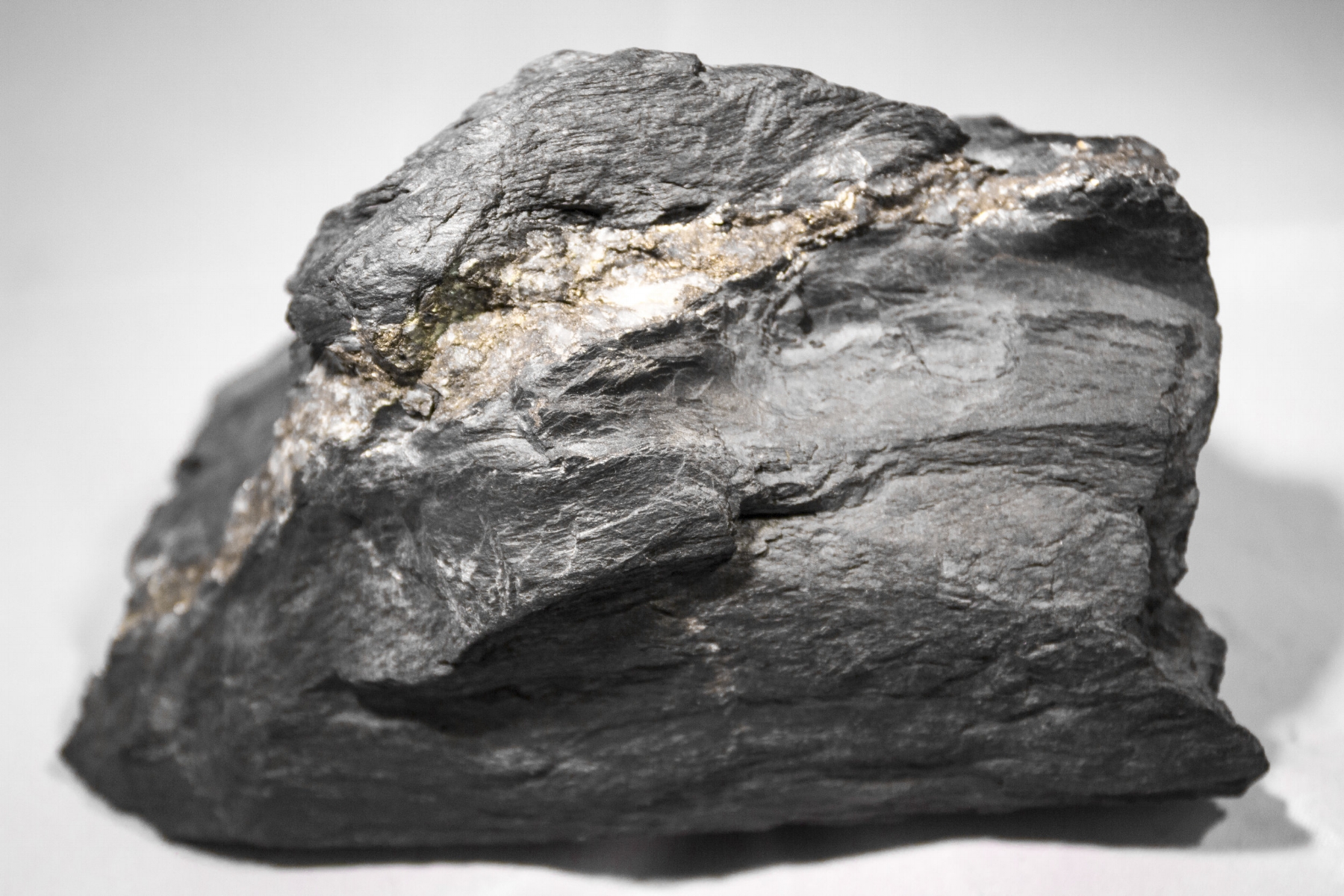
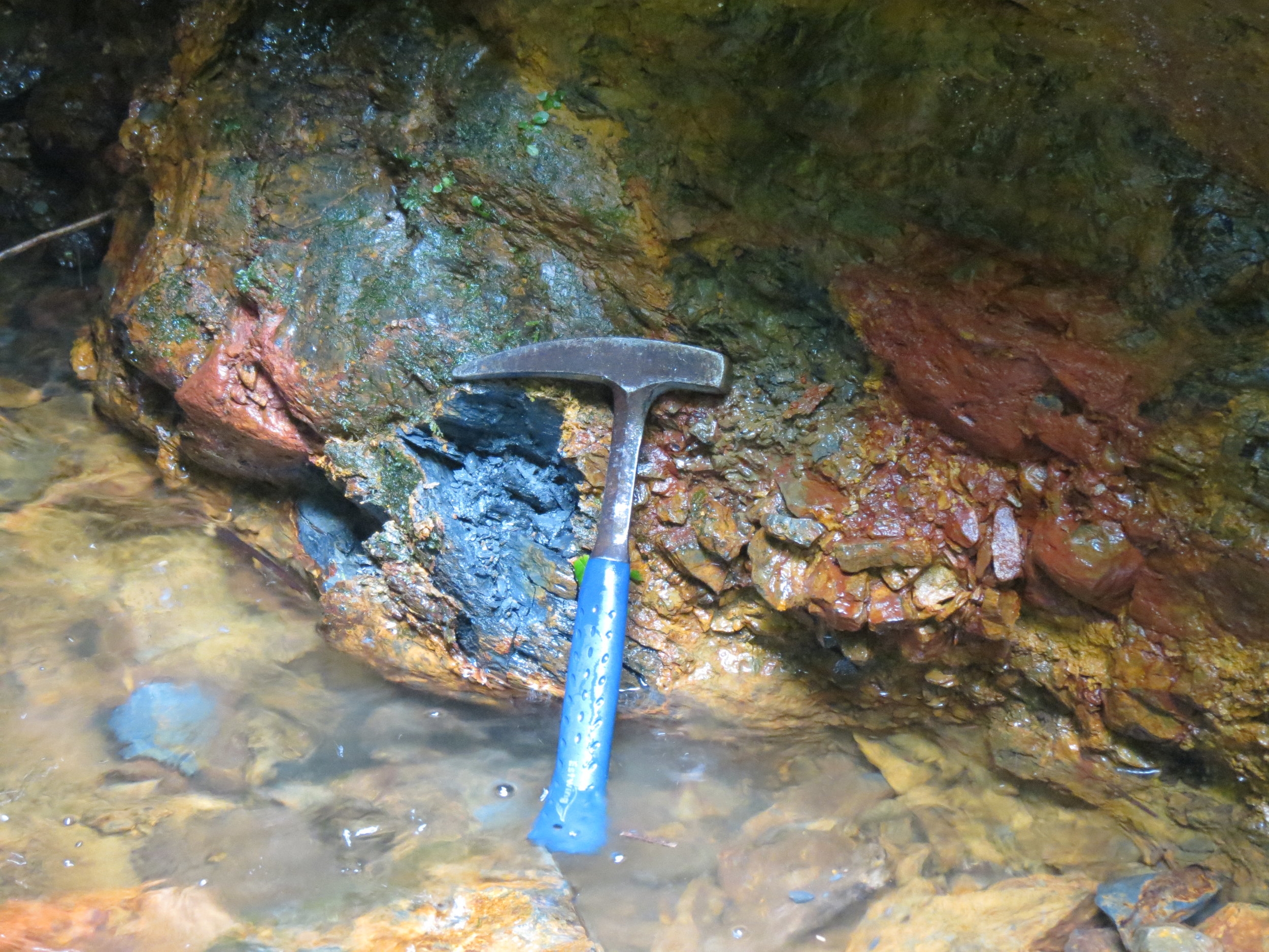
During 2019 – 2021, the previous operator conducted field programs which focused on confirming and defining the extent of the Coritiri zone. A total of 1,120 channel samples have been collected, with highlights including 76 samples assaying between 0.50 and 32.5 grams per tonne gold (“g/t Au”).
Mineralized veins extend over an area of 1,000m by 2,000m, which is currently open, especially to the south and east. The mineralized area correlates strongly with an east-southeast trending aeromagnetic anomaly. Field work completed includes a topographic survey and ortho photo air drone survey to tie in previous sampling programs for drill hole set-up and planning.

The airborne magnetic survey identified several broad magnetic anomalies. A main E-W magnetic corridor hosts the Coritiri Zone, however a secondary NE-SW lineament is clearly visible and remains unexplored. Several gold occurrences have been identified along both structural lineaments and require follow-up.
The previous operator completed an 8.6 km access trail (for personnel and small equipment) to support the 2024 drill program. Additional preparation for the drill program included the construction of a field camp, helicopter pad, and two drill sites. Field work included a topographic survey and ortho photo air drone survey to tie in previous sampling programs for drill hole set-up and planning.
In the fall of 2024, the previous operator completed 4 diamond drill hole covering a total 1,005 metres in the Coritiri zone, from two platforms. Broad zones of gold mineralization in drill holes GABA24-02 and GABA24-04 returned notable intersections, including 4 metres of 5.04 g/t gold and 21 metres of 1.29 g/t gold in shale formations in the two southernmost drill holes completed. Drilling was curtailed due to the early onset of the rainy season, which prevented exploration of the main mineralized zone to the southwest. The DIA environmental permit remains in place with approved drill pads. Palamina will need to reapply and receive a water permit before any drilling activities can resume.


